Spanning 120,000 square miles across the American Southwest and Mexico, this hot desert is home to towering saguaro cacti that live up to 250 years. Visitors can hike 26 miles of designated wilderness trails, stargaze under unpolluted night skies, and observe over 2,000 plant species.
Find Guided ToursThe Sonoran Desert is a hot desert and ecoregion covering between 100,000 and 120,000 square miles across southern Arizona, southeastern California, and northwestern Mexico. Its geography consists of broad, flat valleys separated by scattered, barren rock mountain ranges like the Maricopa, Sand Tank, and Table Top mountains. Elevations rise from sea level near Yuma to 10,000-foot peaks in the eastern sky islands, where the arid terrain transitions into grasslands.
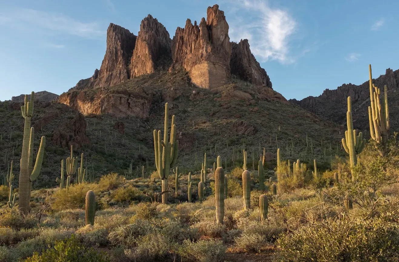
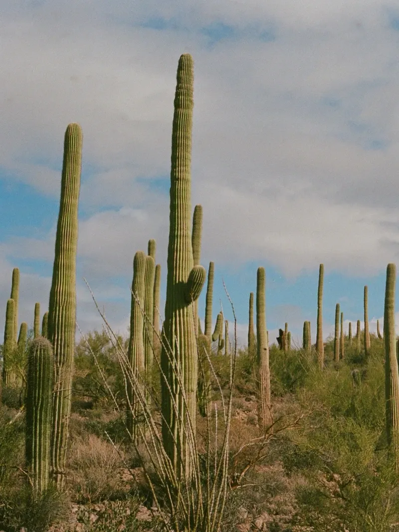
Distinguished by mild winters with rare frosts and a dual-season rainfall pattern, it is the most biologically diverse desert in North America. The landscape supports 2,000 plant species and 550 vertebrate species. It is globally recognized for its massive saguaro cacti, which can live up to 250 years, alongside the distinct organ pipe cacti that serve as key ecological indicators.
Despite the ancient appearance of the landscape, the modern communities of plants and animals found in the Sonoran Desert developed only about 4,500 years ago. This followed the desert's most recent geographical expansion roughly 9,000 years ago. The region is culturally significant, containing ancient Hohokam archaeological sites that mark the early human presence in this challenging environment.
Historically, the desert's central corridor served as a passage for early Native Americans, Spanish explorers, homesteaders, and miners. Remnants of significant historic routes, including the Juan Bautista de Anza, Mormon Battalion, and Butterfield Overland trails, still cross the terrain. On January 17, 2001, President Bill Clinton established the Sonoran Desert National Monument, preserving 496,337 acres of this landscape to enhance resource protection.

Discover the full history and cultural significance on our About page.
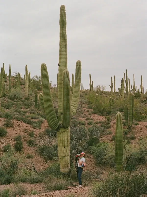
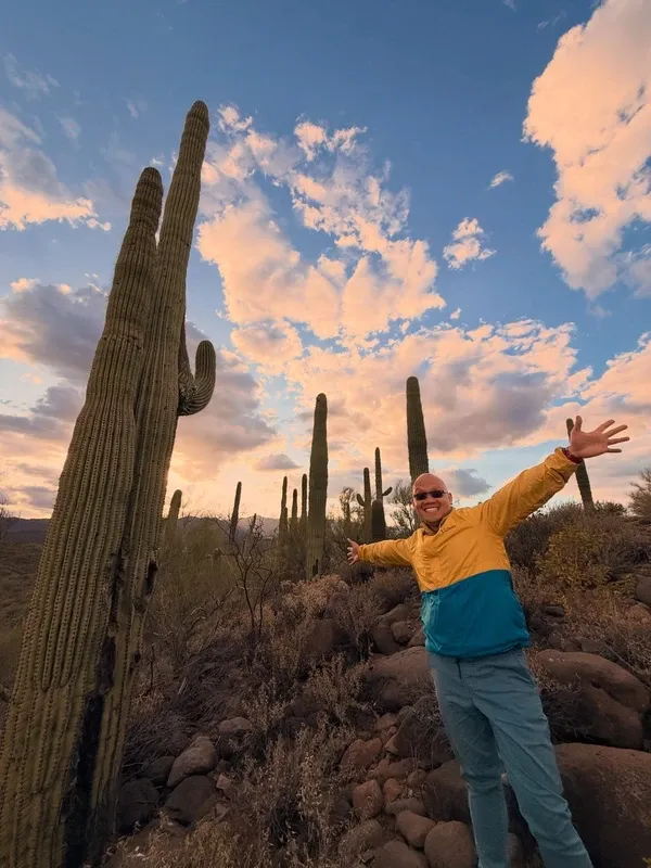
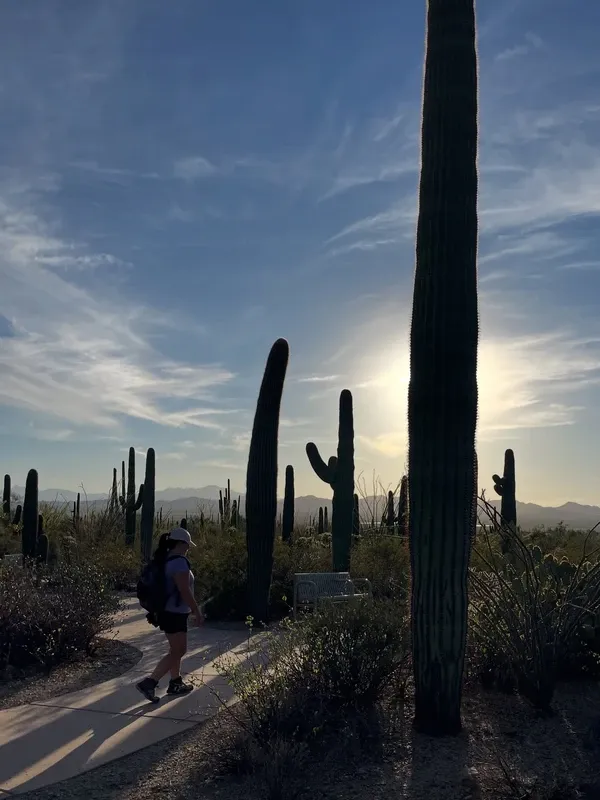
Dense forests of giant saguaro cacti dominate the broad, flat valleys of the national monument. These towering plants, some surviving up to 250 years, define the classic southwestern landscape. Walking among them provides a close look at the 2,000 plant species that make this region highly biologically diverse.
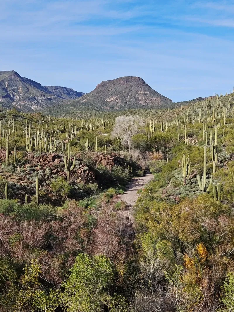
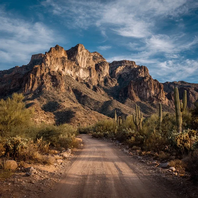
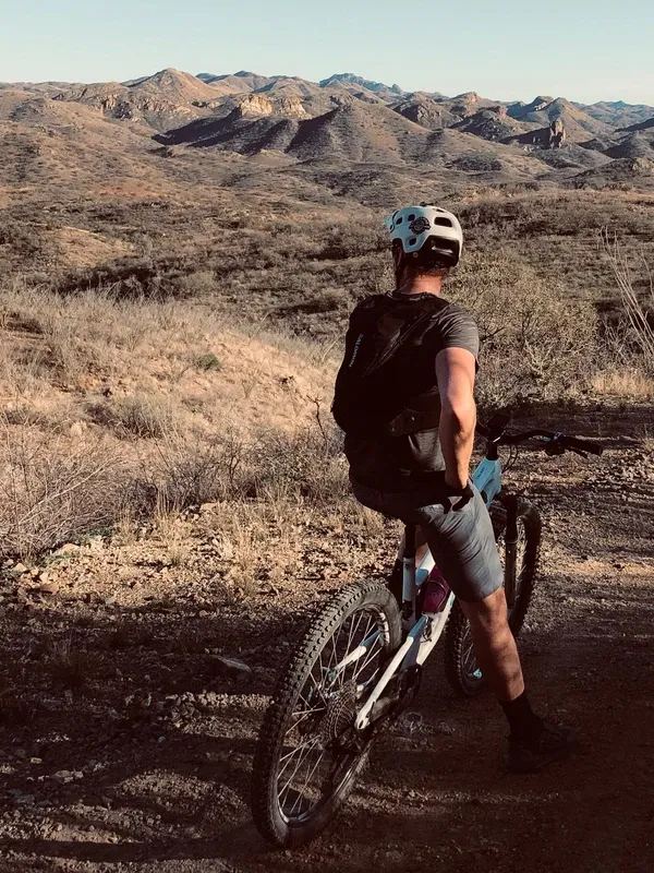
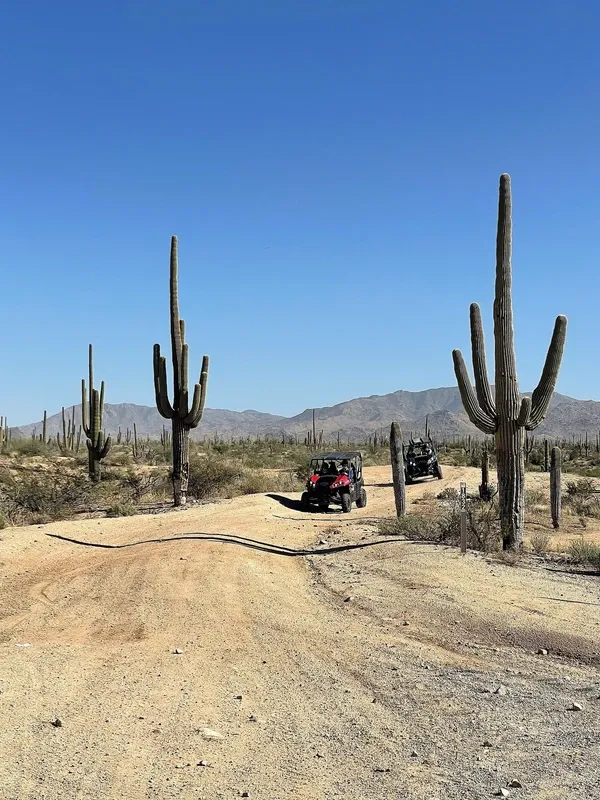
Navigate over 460 miles of posted primitive roads cutting through wide valleys and rugged mountain passes. High-clearance vehicles are essential for this raw desert terrain. Motor touring here reveals the remote beauty of the landscape, though drivers must prepare carefully before leaving paved routes.
The washes and barren rock mountain ranges provide critical habitat for 550 vertebrate species. Patient observers can spot endangered Sonoran pronghorn, desert bighorn sheep, and javelinas. With over 200 bird species documented in the monument, the area serves as a premier destination for dedicated wildlife viewing.
Remnants of legendary routes like the Juan Bautista de Anza and Butterfield Overland trails cross the central corridor. Following these pathways connects hikers to the early Spanish explorers, homesteaders, and miners who crossed this arid landscape long before the 496,337-acre national monument was established in 2001.
Hand-picked tours with free cancellation and verified reviews
 Free Cancellation 2h
  3h 15min
  Free Cancellation 2h
  Free Cancellation 4h
 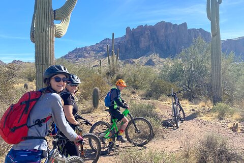 Free Cancellation 3h
  Free Cancellation 2h
  Free Cancellation 2h
  Free Cancellation 2h
 The ideal window to visit the Sonoran Desert is from late October to mid-April, when the weather is mild and comfortable. Visiting outside this timeframe exposes travelers to hazardous temperatures that frequently exceed 110°F.
Early spring offers comfortable temperatures ideal for hiking and camping. However, conditions deteriorate rapidly by late April, bringing intense heat and sun exposure that make outdoor recreation dangerous.
Summer is the most dangerous time to visit the desert. Temperatures regularly exceed 110°F, creating severe risks of heatstroke and dehydration that make daytime outdoor activities extremely hazardous.
September remains dangerously hot, but conditions improve significantly by late October. The later autumn months provide comfortable weather for exploring backcountry trails and camping under clear, unpolluted skies.
Winter provides the safest and most pleasant conditions for exploring the monument. Visitors can expect mild weather with rare frosts, creating an optimal environment for long hikes and wildlife spotting.
The Sonoran Desert National Monument is open 24 hours a day, year-round.
| Category | Price |
|---|---|
| General Admission | Free |
While entry to the national monument and its wilderness areas requires no passes or fees, specific locations and activities do. Visiting the Sand Tank Mountains (Area A) requires a free Barry M. Goldwater Range permit, obtained online after watching a 13-minute safety video. Additionally, recreating on nearby state trust lands requires a permit from the State of Arizona, and organized events with 25 or more participants require a special recreation permit.
For complete schedules and ticket prices, visit our Hours & Fees page.
Accessing the Sonoran Desert National Monument typically requires driving south from Phoenix toward the remote central corridor. While public transit connects airport arrivals to urban botanical sites, exploring the vast backcountry demands a personal vehicle.
Driving is the primary way to access the remote areas of the national monument. From Phoenix, drive 60 miles south on Interstate 10 and transition to Interstate 8 heading west. Take Exit 144 for Vekol Road, turning south to enter the central corridor. Alternatively, drivers can use State Route 238, a paved road between Gila Bend and Maricopa. High-clearance vehicles are recommended for unpaved roads.
The light rail system links Phoenix Sky Harbor Airport to downtown Phoenix, Tempe, and Mesa. This 30-mile transit option is highly budget-friendly for visitors. While it does not travel directly into the remote national monument, the train provides straightforward access to urban attractions. Passengers can easily reach sites like the Desert Botanical Garden or connect with local tour operators for further desert exploration.
For detailed transport options and routes, visit our Directions page.
There is no drinking water available anywhere within the Sonoran Desert National Monument. Visitors must pack at least one gallon of water per person per day. Use a hydration pack and drink continuously before you feel thirsty to combat extreme temperatures that regularly exceed 110°F in summer.
Cellular phone signals are highly unreliable or nonexistent across remote areas of the monument. Download digital maps and GPS routes before entering the desert. Do not rely solely on your vehicle's standard navigation system, and always carry a physical map and compass as a backup.
While the national monument charges no entrance fees, specific areas require advance preparation. Visiting the Sand Tank Mountains south of Interstate 8 requires a free Barry M. Goldwater Range permit. You must obtain this permit online after watching a mandatory 13-minute safety video.
Standard passenger cars often struggle or get stuck on the monument's primitive, unpaved roads. High-clearance or four-wheel-drive vehicles are highly recommended for navigating these unmaintained routes. Ensure your vehicle has a completely full gas tank and carries a full-size spare tire before leaving the pavement.
Scorpions, spiders, and small rattlesnakes frequently seek shelter in dark, cool crevices. Always shake out and inspect your shoes, sleeping bags, and bedding before using them. If you encounter a rattlesnake on the trail, stop immediately and give the animal plenty of space to move away.
Visitors using wheelchairs or mobility devices have several comfortable options for exploring the landscape. The East Skip Rimsza Paseo features a paved concrete surface with a gradual incline. Alternatively, the Desert Botanical Garden offers electric wheelchair rentals, though manual chair users should bring protective gloves.
This facility functions as a combined zoo, botanical garden, and art gallery. Visitors walk outdoor trails to view live desert animals and over 50,000 plants in their natural habitats.
Divided into East and West sections near Tucson, this park protects massive forests of giant saguaros. The terrain features extensive hiking trails, accessible paved paths, and scenic drives.
Located in Phoenix, this garden features five themed trails highlighting over 50,000 desert plants. The grounds include a butterfly pavilion and accessible paths suitable for elderly visitors and families.
Read what travelers share about their experience visiting Sonoran Desert — from practical tips to personal highlights.
There are no entrance fees or passes required to visit the monument or its wilderness areas. However, if you plan to recreate on nearby state trust lands, you must obtain a permit from the State of Arizona.
The best months to visit are from late October to mid-April when temperatures are comfortable for hiking and camping. Avoid visiting between late April and September, as summer temperatures frequently exceed 110°F (43°C) and pose severe health risks.
The southern part of the monument is a 60-mile drive from Phoenix, taking about one hour. Drive south on Interstate 10, transition to Interstate 8 West, and take Exit 144 for Vekol Road to access the central corridor.
You must pack at least one gallon of water per person per day, as there is no drinking water available anywhere within the monument. Wear loose-fitting, light-colored clothing, polarized sunglasses, a wide-brimmed hat, and sturdy closed-toe shoes to handle the rugged terrain.
Yes, the East Skip Rimsza Paseo trail at Apache Wash Trailhead features a paved concrete surface with a very gradual incline. The Desert Botanical Garden also provides accessible paths and offers electric wheelchair and scooter rentals for visitors.
General entry is free, but visiting the Sand Tank Mountains south of Interstate 8 requires a free Barry M. Goldwater Range permit, obtained online after watching a 13-minute safety video. Dispersed camping is permitted without a fee for up to 14 days within any 28-day period.
High-clearance or four-wheel-drive vehicles are highly recommended. The monument contains over 460 miles of unpaved, primitive roads that are not maintained, and standard passenger cars can easily get stuck.
The Valley Metro Rail connects Phoenix Sky Harbor Airport to downtown Phoenix, Tempe, and Mesa for $2.00 per single ride or $4.00 for a day pass. While it does not reach the remote national monument 30 miles away, it provides easy access to urban desert attractions.
Browse verified tours with free cancellation and instant confirmation.
Find Tours